


NOTE: I was encouraged by OgtheKings trip report on the ERL so I decided to post my report. I hiked this trail clock wise starting at the south Athens Big Fork trail head. The road gets very sloppy after prolonged rain, which had happened after Og the King left the trail. This trail is 1.1 miles long that takes you to the Viles Branch trail and the ABF trail. I added to the miles by accidentally hiking the N. access trail to the ABF. So my total miles ended up being around 30.7 miles. If you want info on this trail go HERE you must apply to enter the site but since I am the founder you can consider yourself members!
On Sunday Nov. 23rd late in the afternoon I left for a 3.5 day trip on the Eagle Rock Loop. The pants I am wearing below were bought when I started my weight loss and are big but, I am going to wear them while I can hoping to lose some on this trip! Maybe before long they will just fall off.
You will notice in the pic my loppers. Oh yes! The faithful trail partner for this trip, lol. I had decided to do trail maintenance as I went and that amounted to two extra pounds on my back.
My pack weight, with the Ribzpack loaded, was 25 pounds, which included food but not water and my trusted 8 oz. folding saw. Now that has put me at around 27 pounds. With all being said, I don't plan on doing this again. Really took all the fun out of the trip but, I also really wanted to get some work done on places that have no volunteers to maintain those areas.
I hiked in from the S. access of the Athens Big Fork trail, 1.1 miles. Monday morning I woke up bright and early. I really needed to get started. The pic below is of my hammock, made by Smokehouse, my Hammockgear Incubator 20* underquilt, my JacksRBetter Hudson River 20* topquilt, and the tarp is a Vintage Speer Winter Tarp.
After I broke camp, I was near the start of the ABF on the Viles Branch Trail. I was having doubts about starting on the ABF at first. The wind had picked up overnight and I knew it would be blowing on the Mt. ridges. Since I had told the wife my plan, I decided to stick with it. Everyone seems to talk about a exit plan for the ERL, but I decided there wouldn't be an exit plan for me. Janet, my wife, always says, "There is no back up in me!", so I was going to do this and that was that.
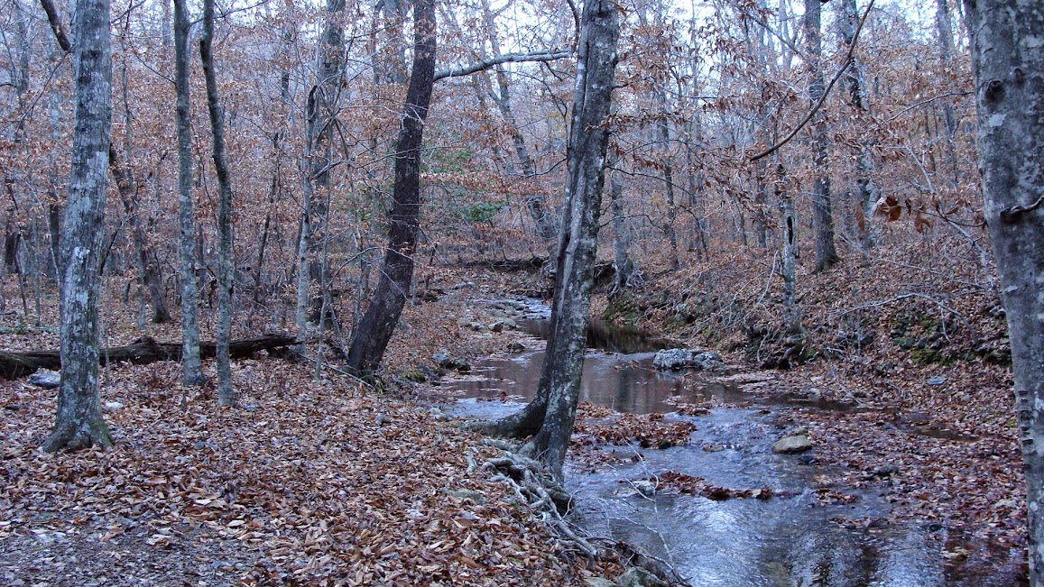
When I started up the trail it was much as I expected. There was not much change since the last time Janet and I had hiked the trail. When I got closer to the Eagle Rock Vista spur I started smelling smoke and thought, yes we have campers on the top. When I reached the top, some very nice folks from Texarkana were there and they had a BIG fire going. I stopped and visited and I dropped my pack and walked to the Eagle Rock Vista. We had a great visit!
I couldn't take pics towards the East due to the bright sun! I wasn't complaining! I tell you it was cool that morning and the sun felt good, really good this morning. I didn't linger long as I headed on off toward E. Saline Creek. Starting from this point on would be new territory for me.
In a very short time I was at the creek and it was very nice. I was so tempted to linger but I knew I had to move on.
After leaving E. Saline Creek I headed up Brushy Heap Mt. When I got to the top, the views were fantastic! I decided to scamper up the side trail to the top and again the views were stunning! When I headed down I met two hikers coming up Brushy Heap Mt. I was glad I was headed down and not up because they seem to be having a rougher time than I was, even though my leg, mainly my left, was giving me problems. I just kept taking one step at a time. It was worth it!
I continued on down Brushy Heap and before to long I had made it to FS rd 106. Shortly there after I made it to Blaylock Creek. When I got to the creek I met two hikers crossing and after they crossed I talked to them awhile and they said that they planned on stopping at Winding Stairs. They had a long way to hike yet!
After leaving Blaylock Creek my next goal was Leader Mtn.
After leaving Leader Mt. I was to cross Brier Creek. and here is were I had a little mishap. The lopper I was carrying shifted as I crossed the creek and fell. Now the problem was the bolt holding the blades. When it fell, the bolt fell on top of my right hand. First thing I thought, and I was wearing gloves, is that sure hurt! I was going to just go on but I saw blood oozing out of the mesh backing of my leather gloves. I took the gloves off and literally my whole hand was covered
with blood. I thought, well this is just great! I took of my pack and held a alcohol swab to the gash to stop the bleeding and cleaned my self up. Well, that took a while. I didn't take a pic because I had to keep the blood of the camera! Should I stop or keep going?
I decided that I would stop for the day at either Long Creek
or Straight Creek, depending on the time I arrived. It ended up being Straight Creek.
I found plenty of color still around when I was there and it was very pretty.
After I had set up camp I met two hikers, in shorts, and it was pretty cold by then. They stopped and talked a bit. One was carrying a scoped 22 cal. rifle.
My miles for Monday came to 7.2.
The next morning I headed up Hurricane Knob.
On my trip on the ABF I had been noticing that ALL of the big down trees have been cut out and the saw dust form the chain saws was still fresh and new blazes had been painted. NOTE: I called the forest service and the fellow that I talked to didn't seem to know anything about this. Either the left hand doesn't know what the right is doing or they aren't talking? Maybe some other group did this? I don't think so, the logistics would be to great. Well, it wasn't to long and I had made it to the N. Little MO trail head and gets interesting. Here is were my journey now will be extended. I came to this:

So now without thinking, notice I said without thinking! Don't do that. Always stop and think it thru!!! I crossed the stream and took a break. Then I saw this:
Well heck I followed it! Now keep in mind I was using Charlie Williams maps. His map doesn't show the N. Access trail. I continued on and I did a lot of TM. I even came to lots of trees cut off the trail.
To make a long story a little shorter: I followed the N. access trail to the end. It came to FS rd B15. I didn't know were I was! Keep in mind I was using ouachitamaps.com maps of the ERL and it DOESN'T show this trail! So I was confused to say the least. I didn't' know at the time but I had hiked an extra 1.4 miles that I didn't have to hike. I hiked back and forth, checked here and there and no blazes! I hiked down to the road which I thought was rd 25, but was actually 83. I hiked down it a little ways and noticed pastures on the other side of a creek. It just didn't' jive! Finally, I flagged down a lady from TX. Funny thing was, I didn't know were I was and neither did she! She took me back to Big Fork and to the
Big Fork Mall. This is a little store and they were a big help to me. I bought a few things and the owner agreed to take me back to the trail. I offered to pay for his gas but he wouldn't except. I was taken on a wild ride back to the trail. I got there late and was able to make it to the bridge to know were for the night. Sure was nice to get there after my adventure, even though I met some really nice folks.
My Miles for the day was 8.3
Wed. morning dawned and I knew I had to make some miles. I was off by 7:55 with one foot in front of the other. I stopped at Little MO falls and emptied my trash.
I noticed the emergency phone list:
I thought this was important. Of course it helps if you can find a phone signal! I then crossed the bridge:
Next I got to the falls:
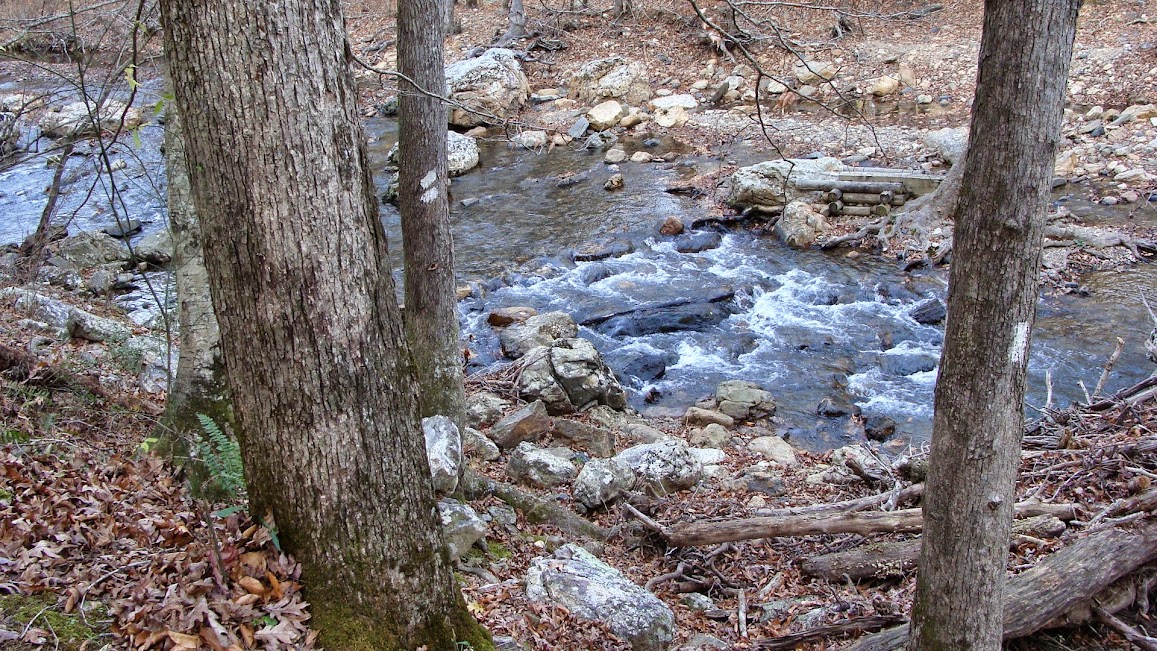
It was beautiful as always! I had to make those all important tracks. I had to go to points south. My next stop was the double crossing:
Which I was able to cross dry. Next was the deep crossing which I got wet.
Next was Albert Pike and a rest stop. Before I got to Long and Brier Creek and also Albert Pike, I had work to do. This next section I had done TM in the past and I did so again. Then I got to this:
Next was Long Creek. I know that this would be a iffy crossing but I got lucky and found a log to cross on:
It wasn't to long and I had made it to Albert Pike. I took up a picnic table and ate some lunch and took a break. The wind had picked up and I was now worried about the weather and It was turning a bit colder also. After a 45 min. break, I left out and climbed the Albert Pike Overlook. Here I was now in our, Janet's and mine, section that we had adopted. I had worked on it back in Sept. but couldn't' finish. I finished it this day
and went on to the Blaylock Creek crossing.
You can see it was rolling on pretty good and I didn't see a way to cross it dry. So, I just went after it. Got across and headed on out. Here I found several big trees down that need to be cut out. Unlike the ABF the FS hasn't worked on them. I did a little work around these trees to hopefully make it a little easier to get under them and across to the other side. Now you pass thru the area of the big blow downs that the FS has cut out. Sure is sad to see all of these trees blown down. It wasn't long till I had made it to the double crossing of the Little Mo.
I made it across the stream just fine and I could hear some hikers. Now I had not seen a hiker since Monday. I got into the Winding Stairs area, which had been around 10 miles for the day up till now, and met the hikers. A couple of boys and one man. They said that they were going to hike the ERL. My opinion was they wouldn't make it. They had only made it 4 miles, and said, they had to stop. The sun was going down and I had decided to get WS behind me.
Now looking at all that, I have decided it was a bad decision. I took some pictures and did some
TM in the area.
I got to the second crossing of the Little Mo and the sun was beyond setting, it was gone! I was really pushed for time. I got in a hurry to get across and I planned to look for a site with a fire ring. I was really getting cold. Up till now I had not had a single fire all week! I set down, got ready, took my loppers off and laid them down. I got up and crossed the stream without any problems. As soon as I got in the river cane on the West side of the river I had to use my head lamp. I kept looking right and left and it all looked thick. I just kept on moving on. I was very tired but kept on going. I am a stubborn old, 62 year old, cuss for sure. I made two crossing of the Viles Branch and got to a big down tree. I got to the other side and took my pack off to rest and I looked around. Were is my loppers?I shined my light back down the trail and new right then and there what I had done. I didn't pick them back up when I crossed the river! Ooooppppppppppppppsssssss I should have camped and went back after them in the morning but I was hoping that the folks I had met would find them and bring them to me. Didn't' happen!
I should have gone back but I didn't. I made camp in a poor spot. The wind really picked up overnight. It was a rocky area, near the 3rd crossing of the Viles Branch, and I had used some large rocks to tie off to. They didn't hold! Thank goodness it wasn't raining. One side of my tarp at one point was flopping and
blew across my hammock. That was a new, bad, feeling! I got up and staked down the tarp and got thru the game. Not much sleep was had for sure.
I broke camp and got going as quickly as I could. It was a cold morning but due to the wind there wasn't any frost. I was tired, needless to say. Hadn't had much sleep and I was up early. I planed on hiking to the end of the Viles Branch to were I had seen a camp site Monday morning and build a fire and dry out and warm up.
I got to the camp site by 9:30. I wasn't to meet up with Janet till 3:00. Now if I had my loppers I could have been working. The Viles Branch Trailis in dire need of some TLC. Now I know it is a horse trail but I bet there are way more hiker boots and shoes on the trail than horses. It is starting to grow up in places. The large trees can't be handled by us. Some of the smaller ones can be taken care of by trail workers such as us. I hope to go down there and do some work, that is when I can afford some more loppers!
I built a fire, there is plenty of wood here including rich pine, and dried out. I made some coffee and even some hot chocolate. I waited till around 11:30 and started up the South access trail. I promptly met a couple from S. LA. They had gotten in around 3:00 in the morning and had gotten thoroughly twisted up trying to come up the trail. They camped for the night and started again in the morning. They didn't have enough time to hike the whole loop and the girl wasn't a experienced hiker so I recommended that they visit the Winding Stairs. I had Charlie Williams PDF of the mileage
for both clockwise and counter-clockwise and gave it to them, I had others at home. I made it to the top of Big Tom Mt. around 12 noon. I got a hold
of the wife and asked her to come and pick me up early. She agreed and told me of the big meal waiting me at home. So you be that now I was for sure ready to go home! I slowly made it down hill and met another family. Two children, a mom, dad and a dog. ALL were loaded down. The mother wished me a "Happy Thanksgiving"
which made my day! In just a short time I made it back to the road. It wasn't long before I heard our truck.
I had made it full circle. 3.5 days and 30.7 miles. More if you count the road walk! Now it was off to Shady Lake to rid myself of the hiker stench and home for a great meal!
My pack weight when I got home amounted to 19.5 pounds.
You can find the full album of photos from my trip HERE


 Reply With Quote


Bookmarks